This post is still a work in progress
This post is a continuation of the previous post, Unfamiliar Hakone Trip (Part One). Last time, I briefly introduced a trip to explore the main parts of Hakone by using the Hakone Tozan Railway, Hakone Tozan Cable Car, and Hakone Ropeway, without using a car or bus. In this Part Two, I would like to continue from there. As we move on to the latter half of this post, I would like to introduce some less familiar aspects of Hakone, as well as some of the sights along the old Tokaido road from the Edo period, where cobblestones are laid in places.
Crossing Lake Ashi
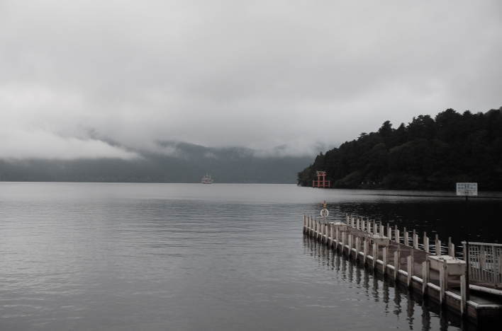
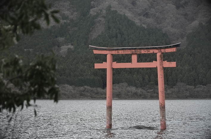
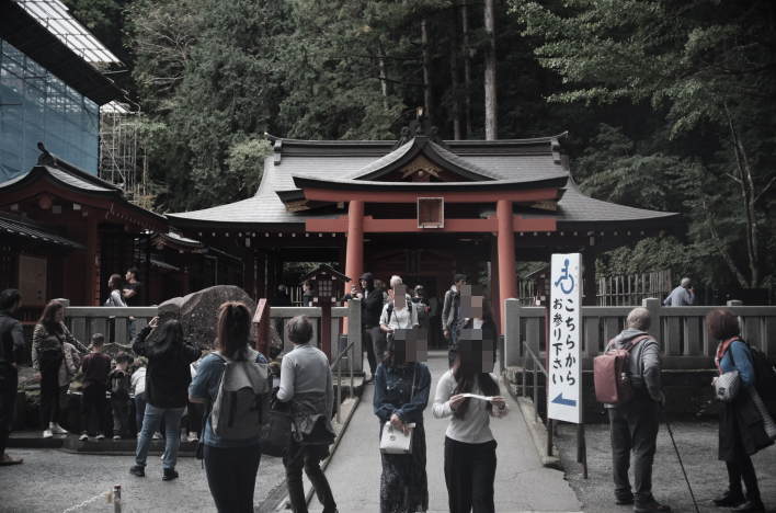
If you take a sightseeing boat from Togendai Station (the terminal station of the Hakone Ropeway) on the northern shore of Lake Ashi and cross the lake from north to south (or vice versa), there are more sights to see on the eastern shore than on the western shore. Therefore, I recommend paying close attention to the eastern side of the lake while on board. Shortly after the boat departs, you will see a red torii gate on the eastern shore. This is the torii gate of Kuzuryu Shrine Hongu (also known as Nine-Headed Dragon Shrine), located in the Kuzuryu Forest on the eastern shore. This shrine (which will be described in detail below) has become very popular in recent years, especially among women, as a deity that grants wishes for success in love.
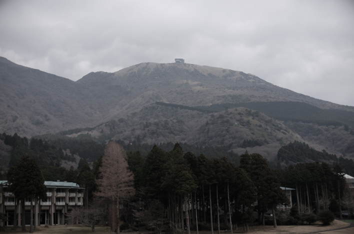
As the sightseeing boat continues on, you’ll see Mount Koma and the ropeway cable laid along its slopes on the eastern side of the lake. This is the Hakone Komagatake Ropeway system, which connects Hakone-en (a leisure complex which contains Hakone-en Aquarium and restaurants, among others) on the lakeshore to the summit of Mount Koma (1357m) over a distance of 1800m in about 7 minutes. 101-passenger gondolas operate at intervals of 10 to 20 minutes. The summit of Mount Koma is a grassy area with great views, making it a good place for a stroll. On a clear day, you can see Lake Ashi, Mount Fuji, Suruga Bay, and the Izu Peninsula from the observation deck at the summit.
At the summit of Mount Koma is the shrine building of Hakone Shrine Mototsumiya. Mototsumiya means “the original shrine.” This is the inner sanctuary of Hakone Shrine, where one can worship Mount Kami (1,438m), the sacred object of worship and the highest peak in Hakone. In Hakone, mountain worship has been popular since ancient times, and the worship of Mount Kami was particularly strong. The summit of Mount Koma, from which Mount Kami can be worshipped from afar, was considered an iwakura rock (derived from ancient animism), and rituals were performed there.
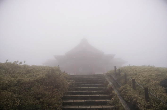
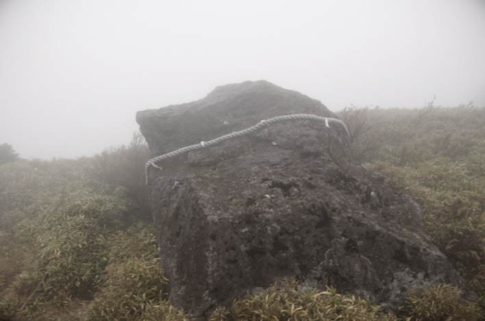
Even today, a fire festival is held at the summit of Mount Koma every year on October 24th, which is said to be a remnant of the ancient rituals to Mount Kami. Near the Mototsumiya shrine is the bakoseki (horse-descending stone) with a shimenawa rope stretched around it. It is said that a deity riding a white horse descended upon this rock. The hole in the rock is a hoof print left when a horse landed, and it is said that the water that collects in this hole has never dried up, even during droughts.
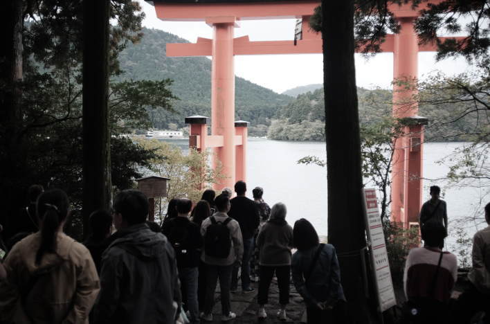
As the lake cruise nears its end and the sightseeing boat approaches Moto-Hakone Port, the torii gate of Hakone Shrine comes into view. This gate is commonly known as the “Torii Gate of Peace” and has become a symbol of Hakone. It was erected in 1952 to commemorate the Rittaishi-no-rei (Ceremony for Proclamation of Crown Prince) of Prince Akihito (later the 125th Emperor) and the signing of the Treaty of San Francisco (also called the “Treaty of Peace with Japan”), which formally recognized Japan’s independence.
The plaque inscribed with the word “Peace” was placed on the torii gate in 1964, the year of the Tokyo Olympics, and the calligraphic characters for “Peace” were written by former Prime Minister Shigeru Yoshida, who signed the peace treaty as the Ambassador Extraordinary and Plenipotentiary. If approaching from land, this torii gate stands at the bottom of the stone steps of the main approach to Hakone Shrine, down to the waters of Lake Ashi. However, since the plaque itself is facing the lake, the characters written on it are difficult to see from land.
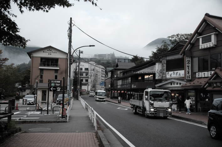
The town of Moto-Hakone, where the sightseeing boat docks (and disembarks), is located southeast of Lake Ashi. Historically, this town has served as a temple town for Hakone Shrine and remains the heart of Hakone today. Centered around the bustling boat dock and bus terminal, numerous hot spring hotels and guesthouses line the streets. Art museums, souvenir shops, and restaurants also dot the area. The large torii gate standing on National Route 1 along Lake Ashi is the first torii gate of Hakone Shrine, followed by the second and third torii gates, eventually leading to the entrance of Hakone Shrine. Furthermore, a short walk along the lakeshore towards Hakone-machi Town reveals historical sites and landmarks such as the old highway with its cedar trees and the Hakone checkpoint.
Hakone Shrine
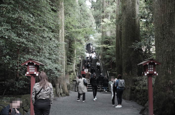
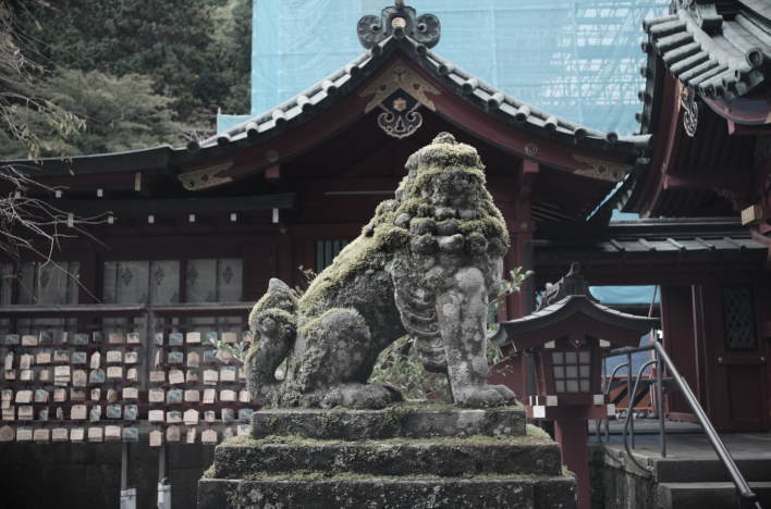
The Hakone mountains were a sacred site of mountain worship where Shugendo practitioners practiced asceticism as early as the 6th or 7th century (long before Hakone became a popular destination for hot spring visitors and travelers). Hakone Shrine, located on the shores of Lake Ashi, is a historic shrine where travelers on the Hakone Road have prayed for safe journeys since the Heian period. As you slowly ascend the 90 steps of the main approach leading to the shrine’s honden (main hall), you are overwhelmed by the sight of towering moss-covered cedar trees on either side. These ancient cedar trees are said to be 600 or even 800 years old, creating a mystical atmosphere. This shrine is famous for its blessings of good fortune, including success in competitions, good relationships, and the fulfillment of wishes. The shrine’s vast grounds are always full of worshippers. It is also known for having been visited by many distinguished people, from Minamoto no Yoritomo to famous modern athletes.
The origins of Hakone Shrine are said to date back to the reign of Emperor Kosho, the fifth emperor, when Mount Kami was enshrined as a sacred mountain. It is uncertain whether this emperor actually existed. Even if he did exist, he reigned in the 5th or 4th century BC, so in Japanese history, he is already a figure of myth. It is said that Hakone Shrine (then called Hakone Gongen) was rebuilt in its current location in 757. This was during a time when Nara was still the capital of Japan. It is said that Mangan, a high-ranking monk who trained in the mountains of Hakone, received a divine message from Hakone Okami in a dream, gathered the deities that were in the mountains, and built the shrine in its current location.
Then, Mangan, with the help of Hakone Okami’s spiritual power, subdued the nine-headed poisonous dragon that was raging in Lake Ashi at the time, causing rough waves and tormenting the people. He enshrined it as the Kuzuryu Okami (Nine-Headed Dragon God), and as a result, peace returned to the lake. This is the legend of the Nine-Headed Dragon of Lake Ashi. At the shrine’s festival held every year on July 31st, a Shinto priest goes out onto the lake in a boat and performs a ritual of offering red bean rice to appease the nine-headed dragon, who is considered the master of Lake Ashi. In other words, it is still believed that a dragon resides in Lake Ashi, and it is enshrined as the deity. The reason why the “Torii Gate of Peace” mentioned above faces the lake can be understood with this legend in mind.
In the Middle Ages, Hakone Gongen was revered as the “Chief Guardian Shrine of the Kanto Region,” a place where Shinto and Buddhism were syncretized. It is particularly known as a shrine that was deeply revered and protected by samurai and warlords of eastern Japan, including Minamoto no Yoritomo, who founded the Kamakura Shogunate, the Hojo clan, who served as regents of the Kamakura Shogunate, and Tokugawa Ieyasu, who founded the Edo Shogunate.
During the Edo period, with the development of the Tokaido road and the establishment of Hakone-shuku and Hakone Checkpoint, Hakone became a key point for east-west transportation. Consequently, Hakone Gongen further developed as a place of prayer for safe travel, attracting fervent devotion from ordinary people as well. In the Meiji era, with the issuance of the Shinto-Buddhist Separation Order in 1868, Buddhist elements were removed, and the name was changed from Hakone Gongen to Hakone Shrine. (“Gongen” is basically a Buddhist term meaning “the appearance of a kami as a temporary form by a Buddha to save sentient beings.”)
The main hall of Hakone Shrine is a magnificent Gongen-zukuri style building, where Hakone Okami is enshrined. When you arrive in front of the main hall, calm your mind and pray according to the proper procedure. Then, express your gratitude for the protection you receive, and make your wish. The procedure is two bows, two claps, and one bow. In the Homotsu-den (the Treasure Hall), you can learn about the history of Hakone Shrine from its founding. It houses a ledger of accounts written by Oishi Kuranosuke, the leader of the Forty-seven Ronin who caused the Ako Incident in the mid-Edo period. This meticulously details the expenses Oishi incurred from the time he left Ako (present-day Ako City, Hyogo Prefecture) until he entered Edo and carried out his vendetta. This is a first-class document for the study of the Ako Incident. Within the grounds of Hakone Shrine, there is also a spring of Ryujin-sui (Water of Dragon God) that purifies all impurities.
Kuzuryu Shrine Hongu
Kuzuryu Shrine Hongu is an outlying subsidiary shrine of Hakone Shrine, located within the Kuzuryu Forest. It is a shrine originating from the “Legend of the Nine-Headed Dragon of Lake Ashi” mentioned above, and enshrines Kuzuryu Okami. Its torii gate standing on the lake is mystical, and the shrine itself is very quiet on weekdays. It is worshipped as a god of financial prosperity, business success, and matchmaking. In recent years, it has become popular for its blessings in love, with many women visiting, hoping to receive romantic power from the dragon god residing in the lake.
To get to Kuzuryu Shrine Hongu, you get off the bus or car at Hakone-en and walk along the lakeside path for about 30 minutes. Access by car or public transport is not ideal. However, Kuzuryu Forest is a park with a variety of plants that grow naturally on the shores of Lake Ashi, such as Japanese stewartia, and walking there while feeling the breeze from the lake is quite a pleasant experience. (Please note that there is an entrance fee to Kuzuryu Forest.) For those who don’t like walking, there is also the option of taking a motorboat from the pier at Hakone-en.
There is sound. Please be sure to wear your headphone.
On the 13th of every month, the Tsukinami Festival (literally, “Monthly Festival”) is held at this shrine. This festival is a celebration to express gratitude to Kuzuryu Okami (the Nine-Headed Dragon God) and to pray for his continued protection. On this day, a special boat service to Kuzuryu Shrine Hongu is operated from Moto-Hakone Port and Hakone-en Port across Lake Ashi. Many people participate in the festival to offer their prayers. At Moto-Hakone Port, you purchase a boarding ticket and are given offerings (to the deity). This is the reception for worshippers, and if you wish to request a prayer during the festival, you apply at this time. In the main hall, the names and wishes of worshippers who have requested prayers are read aloud. Finally, there is a ritual on the lake. The offerings received at the beginning are placed into the lake as an offering to Kuzuryu Okami.
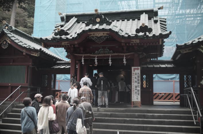
As mentioned above, Kuzuryu Shrine Hongu is located deep in the forest, making it not easily accessible by public transport. Therefore, in 2000, Kuzuryu Shrine’s Shingu (literally, “the new shrine) was built within the grounds of Hakone Shrine as a branch shrine of the Hongu (literally, “the main shrine”) to make it easier to visit. The Shingu is located right next to the main hall of Hakone Shrine, so many people visit the Kuzuryu Shrine Shingu after visiting Hakone Shrine’s main hall. It is believed that visiting the Shingu brings the same blessings as the Hongu, such as matchmaking and business prosperity.
Hakone Aphrodite
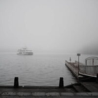
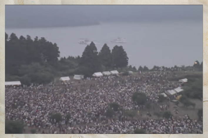
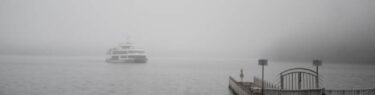
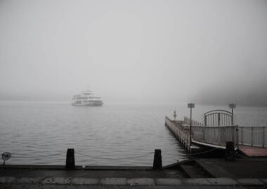
In the previous post, “Unfamiliar Hakone Trip (Part One),” I briefly touched upon John Lennon’s connection to Hakone. And there’s another event where Hakone played a significant role in the connection between major Western popular music figures and Japan: “Hakone Aphrodite,” held on August 6th and 7th, 1971, on the shores of Lake Ashi. Organized by Nippon Broadcasting System, Inc., it was the first large-scale outdoor concert in Japan featuring major international acts, attracting a total of 40,000 spectators over two days. A total of 25 acts from Japan and abroad participated. Regardless of its historical significance, this concert remains deeply etched in the memories of Japanese rock fans, especially as the venue for Pink Floyd’s legendary first performance in Japan, shrouded in fog.
Looking at the trends in the global popular music scene in the years leading up to Hakone Aphrodite, we see that in June 1967, the Monterey International Pop Festival was held on the West Coast of the United States, and in August 1969, the Woodstock Festival was held on the East Coast, both attracting enormous crowds. These events transcended the realm of mere rock concerts and became historical events symbolizing the counterculture of the time. There is no doubt that “Hakone Aphrodite” was planned with the aim of becoming the “Japanese version” of these events.
From overseas, in addition to Pink Floyd, 1910 Fruitgum Company and Buffy Sainte-Marie participated, while from Japan, more than a dozen acts from various genres participated, including The Happenings Four, The Mops, Kosetsu Minami (with Kaguyahime), Toi et Moi, DARK DUCKS, Akai Tori, Kiyohiko Ozaki, Yosuke Yamashita Trio, and Sadao Watanabe Sextet. While outdoor rock festivals featuring international musicians, such as Fuji Rock Festival and Summer Sonic Festival, are now firmly established in Japan, Hakone Aphrodite was a legendary outdoor music event that could be considered the origin of these festivals.
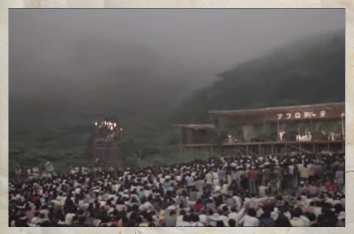
One audience member who attended the Hakone Aphrodite concert on August 6th, Day 1, described Pink Floyd’s performance as follows: “Just as the sun was setting, rain clouds rolled in, and by the time Pink Floyd, the headliners of the event, appeared on stage, a thick fog had spread, obscuring the stage as if a curtain had fallen. Then a gust of wind blew, clearing the fog, revealing the band members, and a huge cheer erupted from the audience. Pink Floyd started their set with ‘Atom Heart Mother,’ followed by ‘Careful With That Axe, Eugene’ and ‘Set The Controls For The Heart Of The Sun.’ And as they began ‘Echoes’ (which hadn’t been officially recorded yet at this point), the fog descending from the mountaintop gradually enveloped the entire stage, and for a moment, the stage (which was originally set high on a slope) appeared to be floating above the clouds.”
There is sound. Please be sure to wear your headphone.
This concert was, in a sense, an unprecedented project, and the Japanese staff involved in setting up the stage at the time, without knowledge or manuals, faced various difficulties. To make matters worse, heavy rain fell the day before the concert, causing vehicles to get stuck in the mud, which had to be pulled out by hand. Photographs still exist showing a bulldozer towing Pink Floyd’s equipment vehicle stuck in the mud.
Pink Floyd used a large-scale PA system, which was still rare in Japan at the time, and Hibino Electro Sound Inc. (now Hibino Corporation) of Japan supported the transportation, installation, and adjustment of the equipment. This is said to have had a significant impact on sound and stage production in Japan ever since. The MC for the day was Goro Itoi, known as a pioneer of Japanese radio DJs. Among the audience were Takao Horiuchi, Daiji Okai, Hidemi Sakashita, Naoki Tachikawa, Masanori Ito, Yoshihiro Hoshina, and Masataka Matsutoya—all of whom would later become musicians, producers, or music critics who exerted a significant influence throughout the Japanese popular music scene.
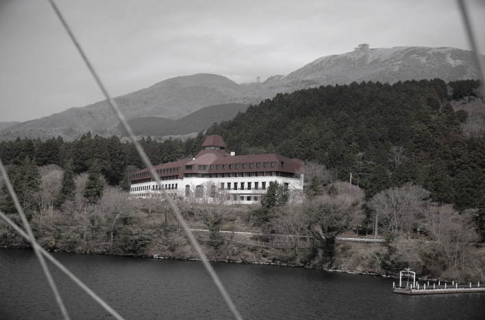
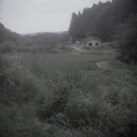
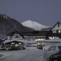
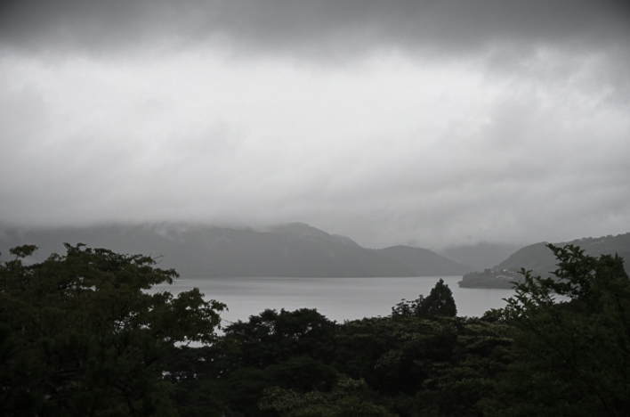
The exact location where this music festival was held is Jofudai, a vast site owned by Seikei Gakuen, on the eastern shore of Lake Ashi. The YouTube clip embedded above shows what Jofudai looks like today (although it’s footage from over 10 years ago), and the soundtrack overlaid on it is Pink Floyd’s performance on August 7th (Day 2 of Hakone Aphrodite). This location is roughly halfway between Hakone Shrine and Hakone-en (Komagatake Ropeway), and from a cruise ship on Lake Ashi, you can use the Odakyu Hotel de Yama shown in the photo above as a landmark. A few minutes’ walk from this hotel along the lakeshore towards Hakone-en (northwest) is the location where “Hakone Aphrodite” was held. If you see Hotel de Yama during your Lake Ashi cruise, be sure to imagine that misty evening in August 1971.
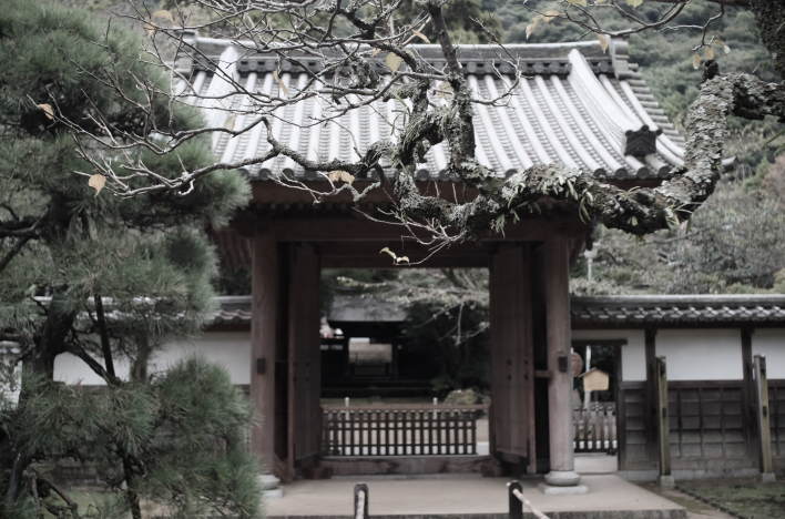
Walking along the Old Hakone Highway
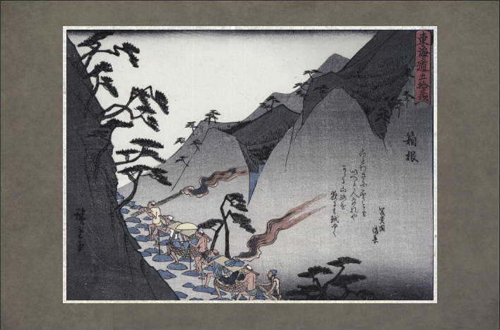
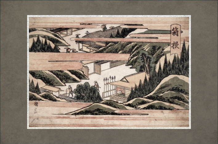
During the Edo period, the Tokaido was Japan’s main artery, connecting Edo (Tokyo) to Kyoto over a distance of 500 km. Within this route, the approximately 32 km section from Odawara-shuku to Mishima-shuku is known as the Old Hakone Highway, where the Hakone Mountains rise majestically. The first half of the Highway, the 16.6 km section from Odawara-shuku to Hakone-shuku, is called the Hakone East Slope and is a difficult section with a continuous uphill climb. Odawara is at an elevation of about 10 to 20 meters, and the elevation difference from there to the highest point of the Tokaido (849m) in the Hakone Mountains is extremely large. Crossing the Hakone Mountains was a great challenge for travelers in the past. Therefore, many tea houses were established along the route, and small settlements developed there.
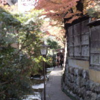
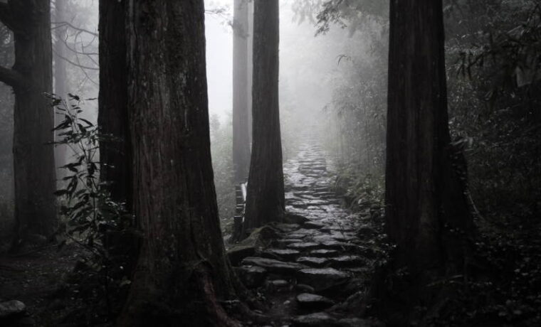
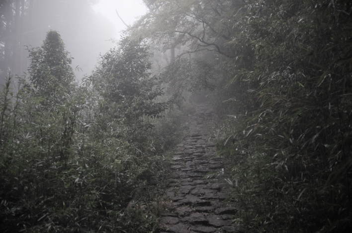
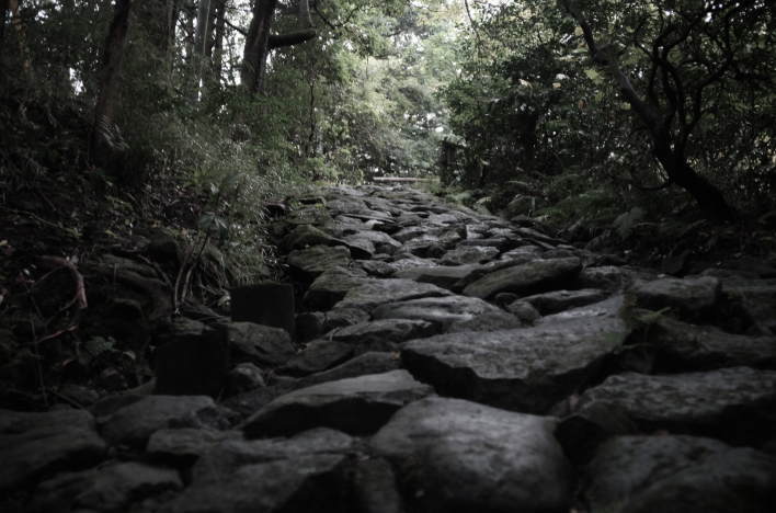
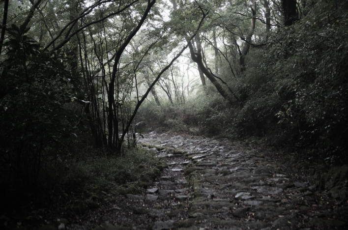
The Old Hakone Highway still preserves its cedar-lined avenues and cobblestone paths, making it the section of the Tokaido that best retains its historical past. When the Highway was first developed in the early Edo period, bamboo was laid to hold down the muddy path, but it was repaved with cobblestones in 1680. However, cobblestones do not remain along the entire length of the Old Hakone Highway today. The course involves walking on asphalt roads, with cobblestone paths appearing along the way, creating a mix of modern and ancient roads. There are seven sections of cobblestones remaining on the Hakone East Slope alone. Most of the existing cobblestone paths date from after the large-scale renovations carried out in 1862, prior to the 14th Shogun Iemochi’s journey to Kyoto.
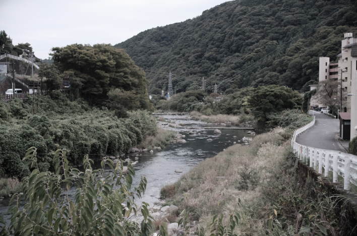
Leaving Odawara-shuku, the old Tokaido Road heads west, running parallel to the Hakone Tozan Railway. Just before Hakone-Yumoto Station, crossing the Sanmaibashi Bridge over the Hayakawa River marks the beginning of the Hakone East Slope. This is the first step towards crossing the Hakone Mountains, said to be the most difficult section of the Tokaido Road. The section from Odawara to Mishima can now be covered quickly by car, but in those days it was the most daunting section of the Tokaido Road, feared as the Hakone Hachi Ri (Eight Ri). The ri in “eight ri” was an old unit of distance, with one ri being approximately 4 km. Travelers in the Edo period were required to carry a travel permit (similar to a passport) and a checkpoint permit.
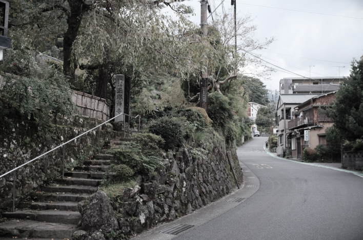
After crossing the Sanmaibashi Bridge and walking for about 10 minutes, you will find So’unji Buddhist Temple on your right. This is a Rinzai Zen temple founded in 1521 based on the will of Hojo Soun (1432-1519), a representative warlord of the early Sengoku period and the first head of the Odawara Hojo family. At that time, the temple grounds extended throughout the entire Yumoto area, and it flourished as one of the largest temples in the Kanto region. However, in 1590, when Toyotomi Hideyoshi attacked Odawara, he set up his headquarters here and later set fire to the temple, causing it to burn down. (The temple bell that was used as a battle bell at that time remains on the temple grounds and is designated as an important cultural property of Kanagawa Prefecture.) In 1627, Kikukei Oshou (Kikukei Soson), who had secretly hidden the treasures of So’unji Temple, rebuilt the temple’s main hall.
Currently, the grounds of So’unji Temple contain the tombs of the five generations of the Hojo clan, as well as the tomb and monument of Sogi (Iio Sogi), a renga poet from the Muromachi period. In 1501, Sogi left Echigo Province with his disciples and continued his journey, holding renga gatherings in various parts of the Kanto region. However, on his way to Suruga, he died in Hakone Yumoto on July 30, 1502. His remains were carried by his disciples over the Hakone mountains and buried at Jorinji Buddhist Temple at the foot of Mount Fuji. The “tomb” of Sogi at So’unji Temple is, to be precise, a memorial tower built for him at the site of his death.
Furthermore, the dry landscape garden behind the main hall dates back to the early Edo period and was created by Hojo Gen’an, the fourth son of Hojo Soun, who lived to be nearly 100 years old, right up until the fall of the Odawara Hojo clan. The main gate (Yakui-mon gate) of So’unji Temple, facing the old Tokaido Road, is designated as a cultural property by Kanagawa Prefecture and Hakone Town. In addition, this temple houses many Edo period art objects and other treasures.
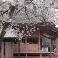
Walking a little further west from So’unji Temple, you’ll find Shogen-ji Buddhist Temple on the left side of the road. This temple originated from the Jizo worship that spread throughout Hakone during the Kamakura period, but it is now a Zen temple of the Rinzai sect. It is an ancient temple associated with the Soga brothers, famous for their revenge. The Soga-do hall, located on the hillside behind the main hall, houses two wooden statues associated with the Soga brothers, which are open to the public during the spring and autumn equinoxes. The weeping cherry blossoms at this temple are magnificent in early April.
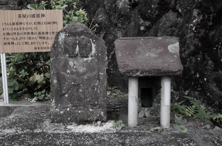
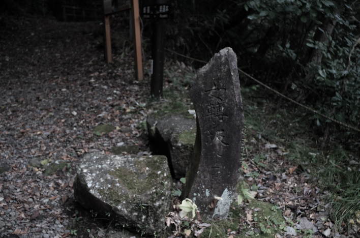
A little further on from Shogen-ji Temple, there is a dosojin (roadside guardian deity). It is a simple dosojin with a man and woman holding hands. Dosojin are deities that are placed along roadsides at village boundaries and mountain passes and are believed to protect people against foreign diseases and evil spirits. Their forms vary, but in the Edo period, they were often depicted as a pair of male and female figures like this one. Near the dosojin, on the right side of the road, stands an ichirizuka monument. Ichirizuka were roadside distance markers erected by the shogunate in the Edo period, marking every ri (approximately 4 km) for travelers, making the distance along the journey clear to them. This is the site of the 22nd ichirizuka from Edo (Nihonbashi).
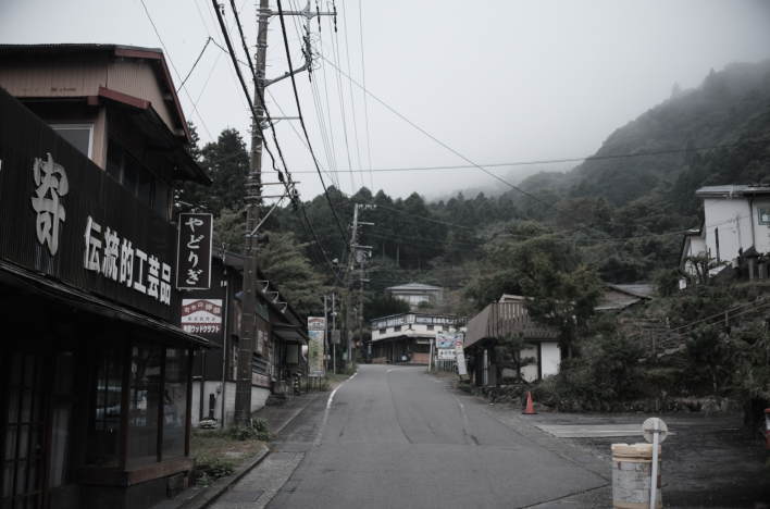
Incidentally, in the Edo period, this area was the boundary between Yumotochaya Village and Sukumogawa Village, and was lined with tea houses and woodturning shops. This section of the old Tokaido Road is now Prefectural Road 732, and despite its narrowness, there is heavy car traffic. There are no sidewalks, so pedestrians need to be careful. From here, the path descends to the right, leading to the first cobblestone section of Hakone. After a short distance, the mountain climb begins, following the Sukumo River, which is a tributary of the Hayakawa River.
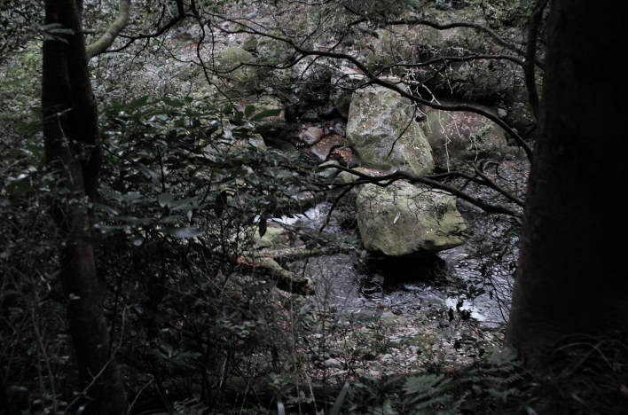
After climbing the Kan’non-zaka Slope and Kuzuhara-zaka Slope and walking a short distance, you will reach Sa’un-ji Buddhist Temple. This area is the setting for “Hakone Reigen Izari no Adauchi,” an Edo period revenge tale that has been the subject of puppet plays and Kabuki, and there are several historical sites related to the story nearby. Crossing the Sukumogawa Bridge, you will come to the site where On’na Korobashi-zaka Slope (literally, “Tumbling Woman Slope”) used to be. This slope got its name from a story that a woman who tried to cross the slope on horseback fell off her horse and died because the slope was too steep. However, the topography is different now than it was in the Edo period, and this slope is no longer so steep. After crossing this slope, you will see the old entrance to Wari’ishi-zaka Slope, where legend remains that the Soga brothers (mentioned above) split a large roadside rock in two to test the sharpness of their swords. After climbing the moss-covered Osawa Slope, which is beyond Wari’ishi-zaka Slope, you will eventually arrive at Hatajuku.
The Hatajuku settlement flourished as an Ai-no-Shuku (literally, “intermediate post town”), which was a settlement established between two post towns for travelers to rest when the distance between them was long or when there were difficult sections. Ai-no-Shuku had tea houses, shops, and rest areas. Hatajuku is located roughly halfway between Hakone Yumoto and Hakone-machi, along the Hakone East Slope. There was once a residence here belonging to a myoshu (village chief) named Myogaya, which was used as a chaya-honjin (a facility for daimyo, court nobles, and shogunate officials to rest and have lunch). It seems to have been a picturesque spot with a waterfall in the garden and a pond where carp swam, and it is said that even Townsend Harris, the US ambassador at the end of the Edo period, was captivated by it.
Hatajuku was originally a village of kijishi, or woodworkers. With abundant timber, woodworking flourished there. Then, in the late Edo period, around the 1840s, Ishikawa Nihei invented Hakone Yosegi-zaiku marquetry, and the technique has been passed down as a traditional craft to this day. Wooden works of Yosegi-zaiku is now a representative souvenir of Hakone. (*However, there is also a theory that the origins of Hakone Yosegi-zaiku marquetry date back to the 9th century.)
Two terms commonly used in Hakone Yosegi-zaiku are zuku and muku. Zuku, in particular, is the most basic technique. First, various types of wood are cut into long, thin rods and combined to create geometric patterns that take advantage of the differences in their colors. The resulting block is then thinly shaved with a plane to form sheets—this is the zuku technique. These sheets are then glued onto the surface of wooden boxes or other items and varnished to complete the product. Various products such as boxes are made using this technique. Yosegi puzzle boxes (which are boxes that cannot be opened unless the instructions are followed) are especially famous and are popular souvenirs.
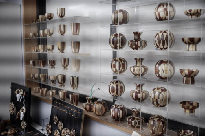
In the case of muku technique, the initial step of combining different colored woods to create a block is the same as the zuku technique, but from there, the thick block is directly carved and processed. Trays and sake cups, for example, are made using this technique. This muku technique is said to have been established by the late Katsuhiro Kanazashi, a certified yosegi-zaiku craftsman. Kanazashi Woodcraft, located in the western part of Hatajuku, was the workshop where he served as representative for many years. His techniques have been passed down to his apprentices, and even today they exhibit and sell works with their own unique muku manufacturing methods and designs. In addition, this workshop has been producing the winner’s trophy for Day-1 of the Hakone Ekiden relay-marathon race every year until 2026.
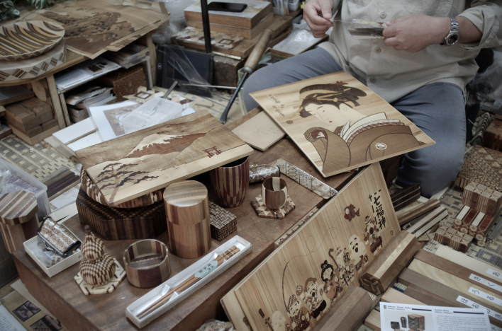
Hakone yosegi-zaiku marquetry was designated a “Traditional Craft of Japan” by the Minister of International Trade and Industry (now the Minister of Economy, Trade and Industry) in 1984. Currently, in the field of yosegi-zaiku, a small number of officially certified “traditional craftsmen” are passing on its skilled techniques. Ichiro Ishikawa, the 7th generation owner of Hamamatsu-ya in Hatajuku, is a traditional craftsman whose ancestor was none other than Ishikawa Nihei. In his workshop on the second floor, you can observe the yosegi process up close. His demonstration of mokuzogan (a woodcraft technique that uses various natural woods to depict landscapes, figures, etc.) is also a must-see. The last time I visited Hamamatsuya was in the winter of 2025, and at that time I was able to observe the production process up close while listening to his explanations and learn about traditional techniques, which was a valuable experience.
Walking west along the old Tokaido Road in Hatajuku, you’ll find earthen mounds on both sides of the road at the edge of the settlement. These two mounds form a pair that constitutes Hatajuku’s ichirizuka. Hatajuku is the 23rd ri from Edo (as mentioned above, one ri is approximately 4 kilometers). The original mounds had shrunk due to exposure to wind and rain, but in 1998, they were restored based on archaeological excavations and historical document research.
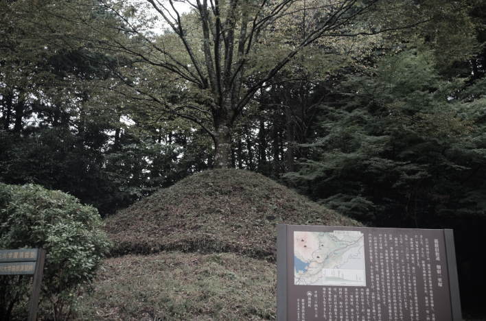
These earthen mounds are constructed by building a stone wall in a 9-meter diameter circle, piling up pebbles, and covering the surface with soil. A fir tree and a zelkova tree were planted on top as marker trees. For travelers, this not only made the distance along the way clear, but the trees planted on top of the mounds also provided shade in the summer and protection from the cold wind in the winter, making them ideal resting places. Usually, ichirizuka are just small stone monuments, but this is the only place in Hakone that conveys the appearance of the past.
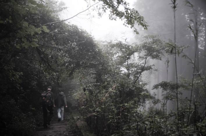
After passing the Hatajuku ichirizuka, the road becomes an uphill climb surrounded by dense trees. Cobblestone paths and paved roads alternate. The paved prefectural road is a section with a series of steep hairpin bends, known as Hakone Nanamagari (or the “Seven Bends of Hakone”). Even when driving, it’s so steep that it’s quite frightening. There are a couple of slopes such as Saikachi-zaka, Kashinoki-zaka, and Sarusuberi-zaka. Kashinoki-zaka (literally, “the Oak Tree Slope”) is probably the most difficult slope on the old Hakone Highway. An Edo-period satirical poem says, “When you cross the Kashinoki-zaka Slope, it is so painful that tears the size of acorns fall,” expressing the hardship of travelers crossing Kashinoki-zaka. Sarusuberi-zaka (literally, “the Slipping Monkey Slope”) gets its name from the story that it is “a slope so steep that even monkeys slip on it,” and although it was once known as a difficult section, it is now relatively easy to walk.
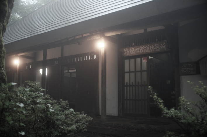
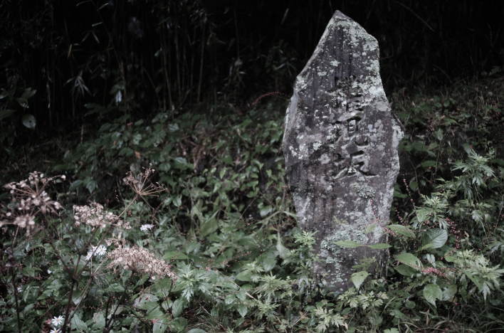
Shortly after passing Sarusuberi-zaka Slope, the road comes to a flat section where the slope ends. This is Oi-no-Taira, a historical site known as the place where Shinran, the founder of Jodo Shinshu school of Buddhism, parted ways with his disciple Shoshin on his way back to Kyoto after completing his missionary work in eastern Japan. An anecdote remains that Shinran gave Shoshin a box called “oi (笈)” containing Buddhist scriptures, and this is the origin of the place name. The monuments commemorating that parting stand at this site today. A short walk west from the Shinran-related monuments will take you to the Hakone Kyugaido Shi’ryokan. This is a free rest area created to evoke the atmosphere of the old Hakone Highway and to allow anyone to rest freely. Inside, there is an earthen floor and a hearth, giving visitors a glimpse into the lives of ordinary people who traveled the Hakone Hachi-Ri (the eight-ri distance of Hakone) in those days.
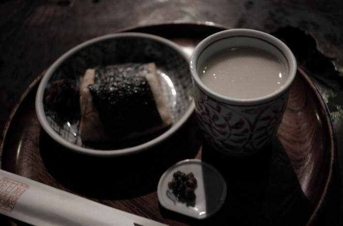
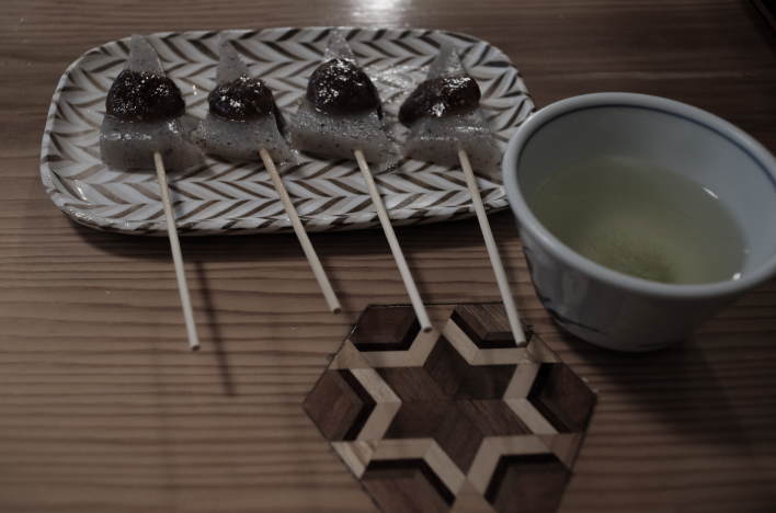
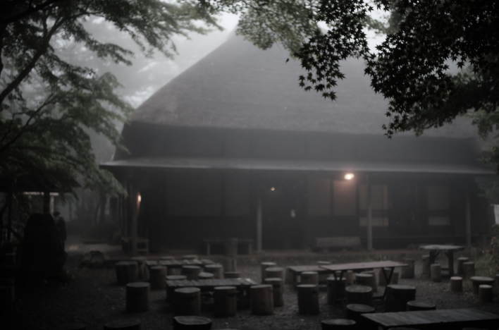
Next to the Hakone Kyugaido Shiryokan is a teahouse called Amazake Chaya. It is said that there were four teahouses in the Oi-no-Taira area during the Edo period, but this is the only one that is still in business today. Amazake Chaya is said to have been founded in the early Edo period, and the building is a traditional structure with a cedar bark roof and no nails used. The shop’s specialties are traditional mochi (rice cakes) and amazake. Amazake is a Japanese traditional sweet drink made from fermented rice. The amazake here is non-alcoholic and does not use sugar, instead utilizing the natural sweetness of homemade koji mold. Their miso oden is also excellent. These foods were a source of nourishment that revitalized Edo-period travelers who were exhausted on the most difficult section of the Hakone Old Highway.
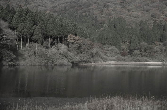
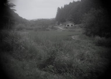
Continuing west along the Old Tokaido Road that passes behind the Amazake Chaya teahouse, you will find Otama Pond (Otamaga-ike) on the north side. This pond is not located along the Old Highway, but rather adjacent to a nearby prefectural road. The pond is beautiful, with its calm surface reflecting Mount Futago (1099m) in the background like a mirror, but its name has a sad origin. Otama (or simply “Tama”) was the name of a farmer’s daughter from the Izu Peninsula who actually existed during the Edo period. On the night of February 10, 1702, she was caught trying to cross the Hakone mountains without a travel permit and was executed on April 27 of the same year for breaking through Hakone Checkpoint.
At that time, breaking through a checkpoint was punishable by death. One theory is that Otama Pond was named as such because Tama’s severed head was washed there after her execution. A little further west from this pond, near the Old Highway, stands a small shrine called Otama Kannon-do. This shrine was built to hold a memorial service for the spirit of Otama, and also to hold a memorial service for the spirits of those who died without relatives in the Hakone Mountains and around Lake Ashi.
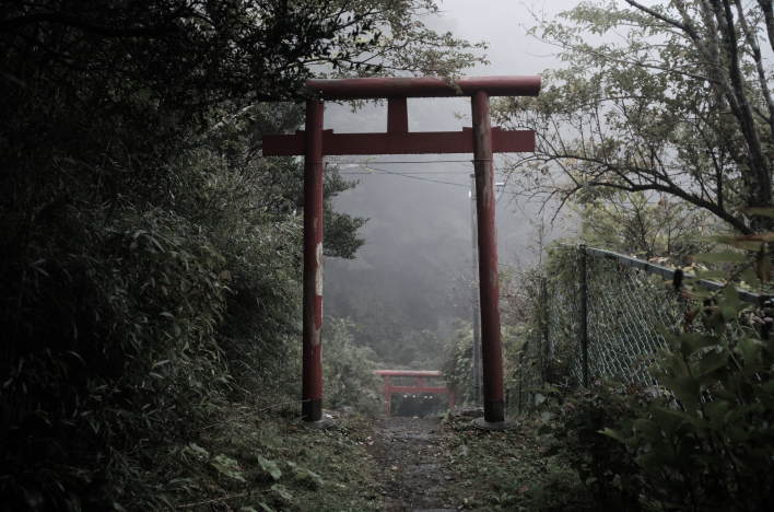
Returning to the Old Hakone Highway from Otama Kannon-do, a short walk leads to Gongen-zaka Slope. Around here, the mountain path ends, and the slope of the road gradually flattens out. The view ahead brightens, and Lake Ashi is close by. Travelers who had climbed the Hakone Eastern Slope from Odawara-shuku would have finally been able to catch their breath around Gongen-zaka after struggling to overcome several steep slopes and difficult sections. Near this slope is a red wooden torii gate, from which a narrow approach path extends up the hill. At the end of the approach is a small shrine, with a very small torii gate and an offering box at the base of an old tree, indicating that this is an object of worship of some kind. Descending the Gongen-zaka Slope and crossing the pedestrian bridge, you will find the monument to Kaempfer and Birnie.
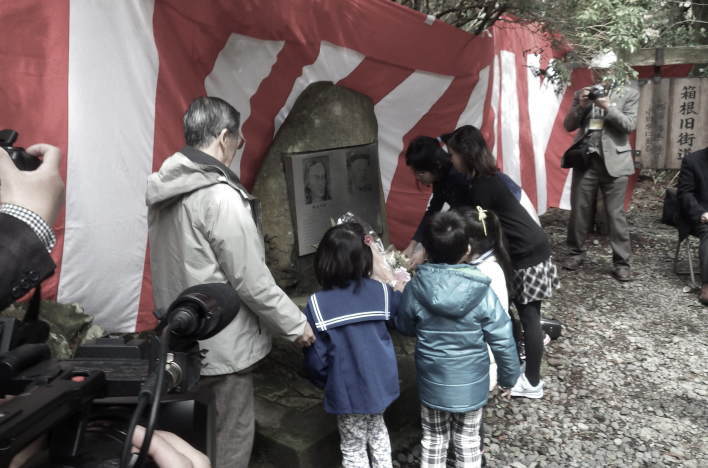
This Kaempfer-Birnie Monument is a stone monument honoring two figures associated with Hakone: Engelbert Kaempfer and Cyril Montague Birnie. Kaempfer, a German physician and naturalist, came to Japan in 1690 and stayed in Dejima in Nagasaki harbor as a physician for the Dutch trading post. He visited Edo twice, in 1691 and 1692, as part of the “Dutch missions to Edo,” crossing Hakone. In Edo, he had an audience with Tokugawa Tsunayoshi, the fifth shogun of the Edo shogunate. During his stay in Japan, he observed Japanese history, religion, and plants, and after returning to his home country, he published a book titled Amoenitates Exoticae. After his death, The History of Japan, a compilation of his writings on Japan, was published. Birnie, an Australian merchant, was deeply impressed by this book. He came to Japan in 1885 and built a villa in Hakone, and in 1922 he erected a monument inscribed with the preface to The History of Japan.
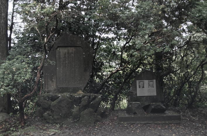
The photo above shows two monuments. The one on the left is what is known as the “Birnie’s Monument,” and it was erected by Birnie himself. He erected this monument with the message that Hakone’s natural environment must be protected from industrial development and preserved for future generations. This monument has a quote from Kaempfer’s book, The History of Japan, inscribed in Japanese. The monument on the right is the Kaempfer-Birnie Monument, which has reliefs of the two men embedded in it. This monument was erected by the “Kaempfer-Birnie Commendation Society” to honor the achievements of Kaempfer and Birnie.
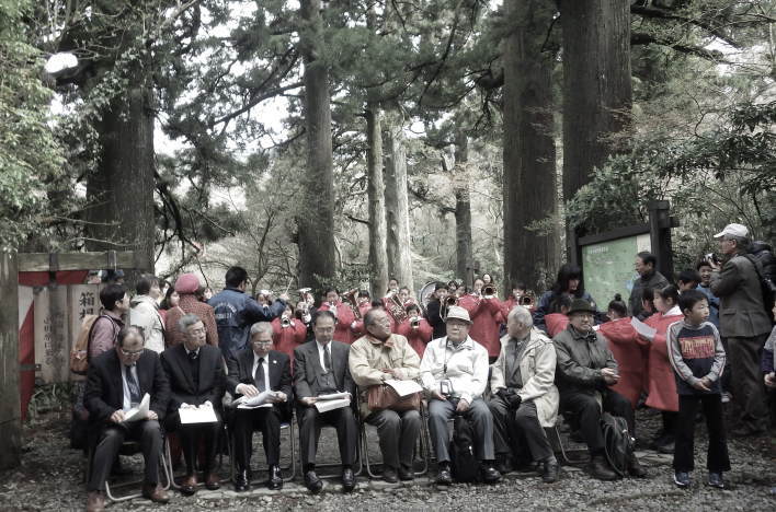
The residents of Hakone today still revere Kaempfer and Birnie and continue to uphold their spirit. For example, Hakone Kohansou, a restaurant in Moto-Hakone, has a menu item called “Kaempfer Udon Nabe,” and the restaurant provides the following comment about this dish: “Kaempfer-san, as the author of The History of Japan, was the first to introduce the beauty of Hakone’s nature to the world. We named this dish with gratitude to Kaempfer-san and with the intention of ensuring that his achievements are not forgotten and passed on to future generations.” The aforementioned Kaempfer-Birnie Commendation Society (“ケンペルとバーニーを讃える会” in Japanese) is an organization formed by local residents, and they have been holding the “Kaempfer & Birnie Festival” every April since 1986. At this festival, events such as a ceremony in front of the monuments, lectures on nature conservation, and social gatherings, are held to pass on the spirit of nature conservation to the next generation.
Incidentally, Kaempfer’s The History of Japan, mentioned above, was published in English and French at the time and was a primary source for European intellectuals in the 18th and 19th centuries to learn about Japan. It is said that Goethe, Kant, and Montesquieu also read it. Furthermore, Commodore Matthew Perry, after being ordered to go to Japan in the mid-19th century, read this book along with Philipp Franz von Siebold’s works on Japan as a reference book to learn about the country.
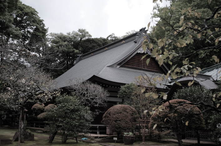
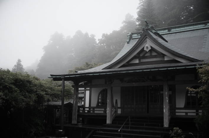
A short walk from the Kaempfer-Berney Monument leads to the Buddhist temple, Zuiryuzan Kofukuin. Originally founded as a sub-temple of Hakone Shrine, it converted to the Soto Zen sect during the Edo period and has since become an important temple serving the local community. While you don’t see many tourists here, the temple grounds have a refreshing yet dignified atmosphere befitting a Zen temple, making it one of my favorite places. The Otama Kannon-do mentioned above, which commemorates the spirit of Otama, is also managed by this temple. After passing this temple, you soon reach the road along Lake Ashi, which is the National Route 1. A short walk from here leads to Moto-Hakone Port, where the vermilion color of the first torii gate of Hakone Shrine is strikingly vibrant. Nearby are the Narukawa Art Museum and Sai-no-Kawara.
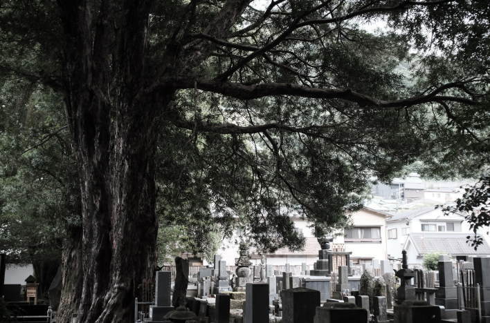
The Sai-no-Kawara is a fenced-off area in front of the Lake-Ashi sightseeing boat dock in Moto-Hakone, where many stone Buddha statues and stupas are lined up. This is a relic that tells the story of the time when Jizo worship was flourishing in Hakone. In the Buddhist worldview, after death, people cross the Sanzu-no-Kawa (Sanzu River) to go to the afterlife, and the Sai-no-Kawara (or “River-plain of the Dead”) is located just before this mythological river. It is said that the Oni (demons) come here and torment people, but Jizo appears and saves them. Because of this, the story of Sai-no-Kawara became associated with Jizo worship, giving rise to sermons, hymns, and prayers. During the Edo period, the shores of Lake Ashi along the Tokaido road were likened to the Sai-no-Kawara, and many stone Buddha statues and stupas were erected there. Kaempfer’s History of Japan, mentioned above, states that there were five Jizo halls at the Sai-no-Kawara in Hakone, and the sounds of Buddhist chants and gongs could be heard.
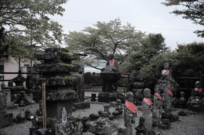
During the Meiji era, when the Shinto-Buddhist Separation Order was issued, many Buddhist-related stone structures were destroyed or lost. Afterwards, the stone Buddhas and stupas that remained throughout Hakone were gathered in one place to create the “Sai-no-Kawara,” which we see today. (As mentioned above, ‘Sai-no-Kawara’ itself is a term originally derived from Buddhism, so there are many places called by the same name throughout Japan.) Now, amidst the constant flow of cars and people, and the magnificent view overlooking Lake Ashi, it is difficult to imagine that this place was, until the Meiji era, the boundary between this world and the next—that is, the most terrifying place in the Hakone mountains. Not many tourists stop to look at the stone structures. However, these ruins are extremely valuable, and some date back to the late 14th century.
From the vicinity of the Sai-no-Kawara, a row of cedar trees stretches for over 500 meters along the Hakone Old Highway. The cedar trees planted here are approximately 350 years old, and there seem to be about 400 of them. A sacred atmosphere permeates the area, and you can enjoy a walk as if you were taking a forest bath (shinrin-yoku). This area is one of the busiest tourist spots in Hakone, but this tree-lined road, running parallel to National Route 1, retains the atmosphere of the Edo period, far removed from the hustle and bustle of the lakeside. The path is also flat and easy to walk.
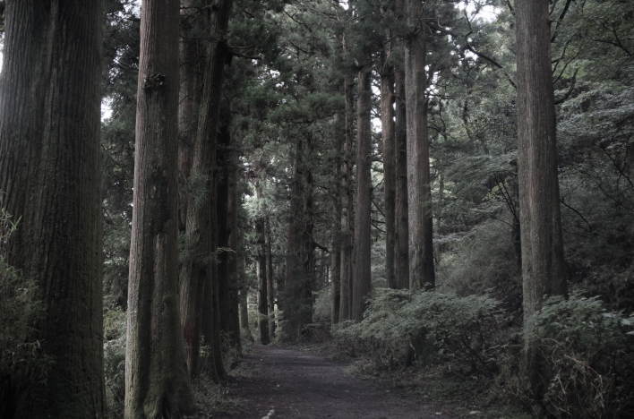
In the first half of the 17th century, the Edo shogunate planted trees along the Tokaido Road to protect travelers from wind, rain, and sun. While pine trees were commonly planted along this historical road, the area around Lake Ashi is strangely lined with cedar trees. According to one theory, pine trees were initially planted, but they did not grow well due to Hakone’s cool climate. Therefore, the pines were later replaced with cedars. Like Nikko (in Tochigi Prefecture), Hakone has underground water veins. Because of the abundance of water, Hakone is suitable land for cedar trees to grow. As a result, magnificent rows of cedar trees are still maintained there today.
After walking along the cedar-lined road, you’ll arrive at the parking lot of Onshi Hakone Park. Onshi Hakone Park is located on a small peninsula called Togashima that juts out into Lake Ashi. This site was once home to the Hakone Imperial Villa, built for the imperial family’s summer retreats and to entertain foreign dignitaries. After the villa’s buildings collapsed in earthquakes, it was opened to the public after World War II and became a prefectural park. The vast, lush grounds are home to a variety of flowers and plants throughout the seasons. Kohan Tenbokan (literally, “the Lakeside Observation Hall”), currently standing in the central plaza, is a white granite-clad building that recreates the appearance of the former main building of the Imperial Villa. From the second-floor balcony of this building, one can enjoy a spectacular panoramic view of Lake Ashi and Mount Fuji on a clear day.
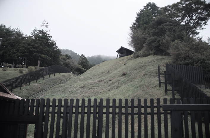
If you follow the path that extends from the side of the Onshi Hakone Park parking lot towards Lake Ashi, you’ll reach the Hakone Sekisho (Hakone Checkpoint). Sekisho was a shogunate observation post that controlled the movement of travelers. During the Edo period, there were more than 50 sekisho throughout the country. The Hakone Sekisho, established in 1619, was large in scale and played an important role. Its main role was to crack down on de-on’na. De-on’na (literally, “outgoing women”) were women who ran away from Edo. (The Edo shogunate held the wives and children of provincial feudal lords hostage in Edo and enforced regulations to prevent them from returning to their home provinces without permission.) Passersby were subjected to rigorous investigations, including verification of their identification documents and their destination.
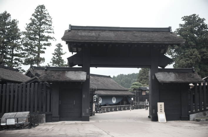
The Hakone Sekisho, which had been used during the Edo period, was abolished in 1869, and the buildings were demolished. For a long time afterward, the checkpoint buildings were not rebuilt. However, in 1983, a report on dismantling and repair work carried out at the end of the Edo period was discovered, and based on this, restoration work began in 1998. In 2007, the work was completed, and the fully restored Hakone Sekisho finally opened to the public. Today, the Hakone Sekisho is a popular destination, highly recreating the appearance of the checkpoint from the Edo period. Inside a building, mannequins are used to recreate scenes of travelers being interrogated. In addition, related materials such as checkpoint passes can be seen in the adjacent museum.
The current Hakone Checkpoint is built on the same site as the one from the Edo period. As can be seen from the topography, the Edo-period checkpoint was built on a narrow plot of land with steep mountains behind it and Lake Ashi in front. The checkpoint grounds were surrounded by a fence and had the sturdy gates. In addition, a lookout post was set up on the hill behind the checkpoint.
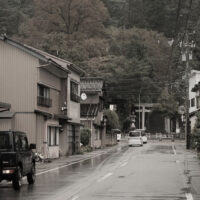
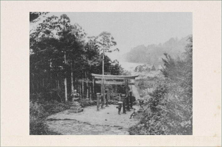
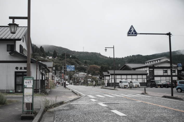
After leaving the checkpoint, you proceed straight down a street lined with souvenir shops and restaurants to reach National Route 1. In the Edo period, there was a kosatsu-ba (a place where laws and regulations set by the shogunate or feudal lord were written on a wooden plaque and displayed high up for public view) just outside the Hakone Checkpoint, and that’s where Hakone-shuku began. At that time, Hakone-shuku was one of the busiest places in Hakone, along with Moto-Hakone. Of the 200 houses, there were 6 honjin (the highest-ranking lodging facilities where daimyo and court nobles stayed) and 39 other inns. After crossing the steep slopes of the Hakone mountains, the daimyo (feudal lords) riding in palanquins and their entourages traveling on foot must have wanted to rest properly at Hakone-shuku.
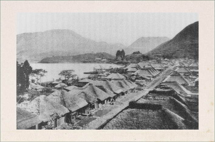
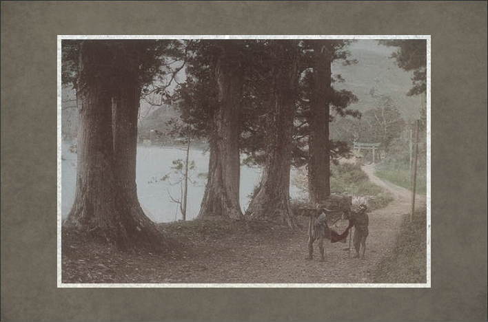
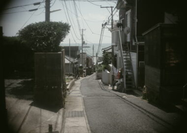
The photograph above appears to have been taken in the late Meiji period, but the streetscape still evokes the atmosphere of Hakone-shuku during the Edo period. A little further in the distance, the peninsula jutting out into Lake Ashi is Togashima, and as the title of the photograph suggests, an imperial villa stood on top of this hill at the time. The base of this peninsula is where the Hakone Checkpoint was located, and the large mountain towering behind the peninsula is Mount Koma.
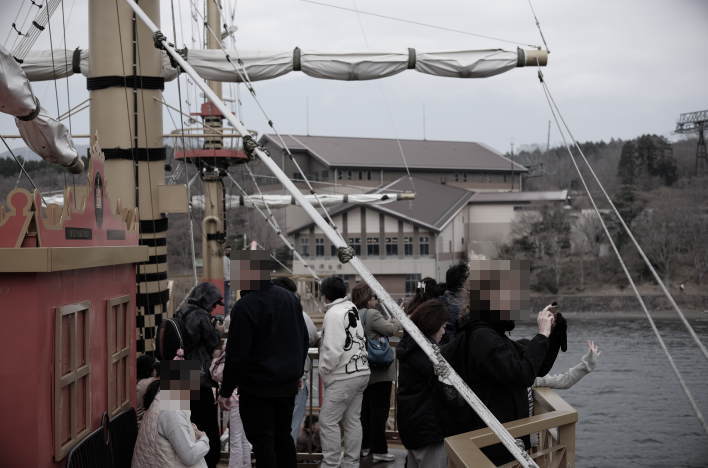
The area that was once Hakone-shuku is still a tourist spot lined with inns and souvenir shops. Nearby, on the shores of Lake Ashi, is Hakone-machi Port, which serves as a departure and arrival point for pirate ships. This area, at an altitude of approximately 730 meters, is the highest of the post towns along the Tokaido Road, making it unsuitable for rice cultivation. It is said that the first residents of Hakone-shuku, established during the Edo period, were people forcibly relocated from the neighboring Odawara-shuku and Mishima-shuku. Even today, many of the townspeople living in this area are engaged in the tourism industry.
Getting There
Other Photos
Other Places in Hakone
Last Statement & Contact

Photo Credits, Sources, and Acknowledgements
Photographs by Koji Ikuma, unless otherwise noted. (Featured photo: “The Old Tokaido Road in the Hakone Mountains.”) Sources for this post include: 司馬遼太郎『箱根の坂(下)』講談社 (2004) ; レジ―『夏フェス革命』blueprint (2017) ; 志田威『東海道57次』ウェッジ (2015) ; 岡本永義『東海道五十三次 四百年の歴史を歩く』けやき出版 (2010) ; 本多隆成『歴史の旅 東海道を歩く』吉川弘文館 (2007) ; 森川昭『東海道五十三次ハンドブック改訂版』三省堂 (2007) ;
Outbound Links (New Window)


")

")


")