Overview
The Kyushu Region includes the westernmost areas of Japan. And it consists of eight prefectures: Fukuoka, Saga, Nagasaki, Kumamoto, Oita, Miyazaki, Kagoshima, and Okinawa.
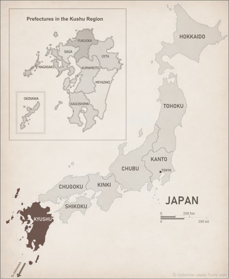
Roughly speaking, the Kyushu Region can be divided into two parts. One is the main island of Kyushu, the third largest of Japan’s four biggest islands, and the many small islands immediately surrounding it, most of which are concentrated on its western side. The other is a lengthy southwestern island chain extending from the southern coastal waters of Kyushu’s main island almost to the waters off of Taiwan.
Map of Southwestern Japan Islands
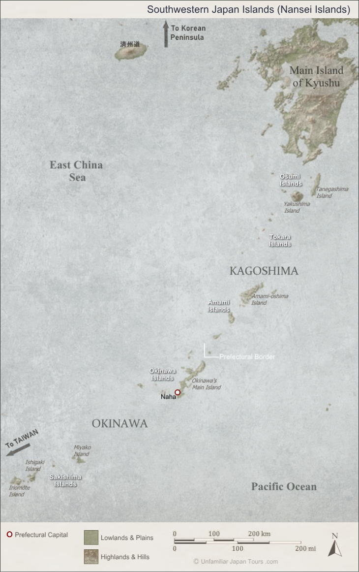
The latter spans over 1,000 km and is collectively called the Nansei Islands. This southwestern archipelago actually consists of five different island groups. They are, in the order from the northeast to the southwest, the Osumi Islands, the Tokara Islands, the Amami Islands, the Okinawa Islands, and the Sakishima Islands. Administratively, the former three belong to Kagoshima Prefecture and the latter two belong to Okinawa Prefecture.
Climate of Kyushu
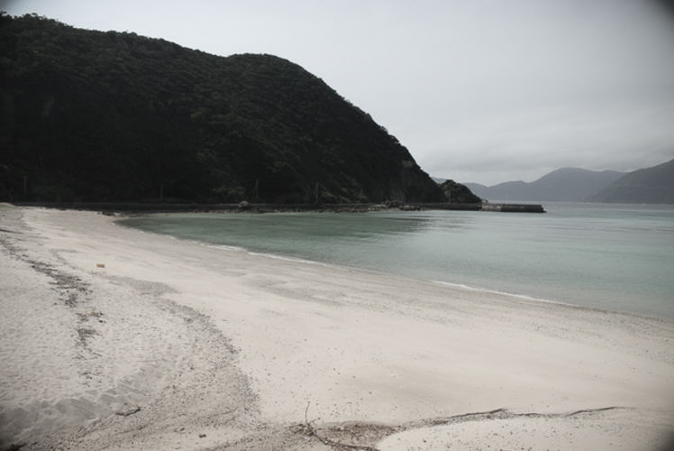
The Kyushu Region generally gets a lot of rainfall, mainly because of the southern seasonal wind that blows in summer. This wind brings a mass of humid air. In particular, the rainy season, beginning in June (in May in Okinawa), sometimes means a cloudburst. And in the worst cases, it can lead to serious disasters entailing floods, landslides, and mudslides.
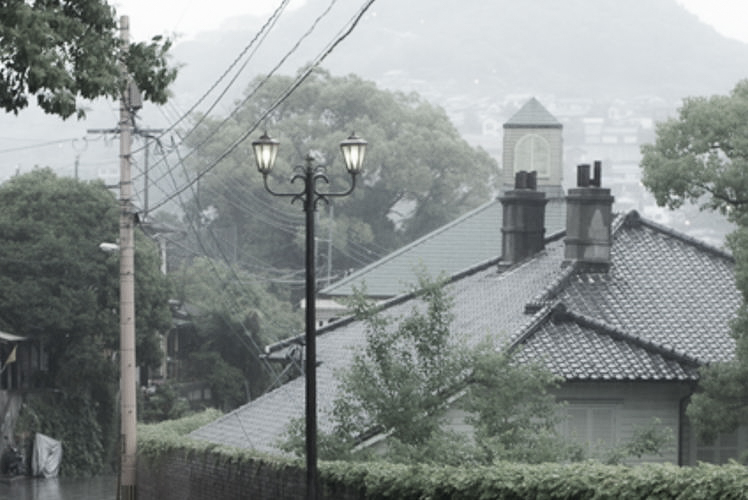
When we speak of the winter climate on Kyushu’s main island (here, excluding Okinawa and its surrounding archipelagoes), we can say that it is relatively warm. This is mainly thanks to the two warm ocean currents that pass nearby. They are Kuroshio (Japan Current) to the south and the Tushima Current to the north. But if you visit here in winter for the first time from Tokyo, for example, you might be a little disappointed to find that it is not as warm as you expected it to be. At any rate, the winter temperatures of Kyushu’s main island are higher than those of Tokyo, but not that much higher.
Map of Kyushu
Climatic Difference within Kyushu
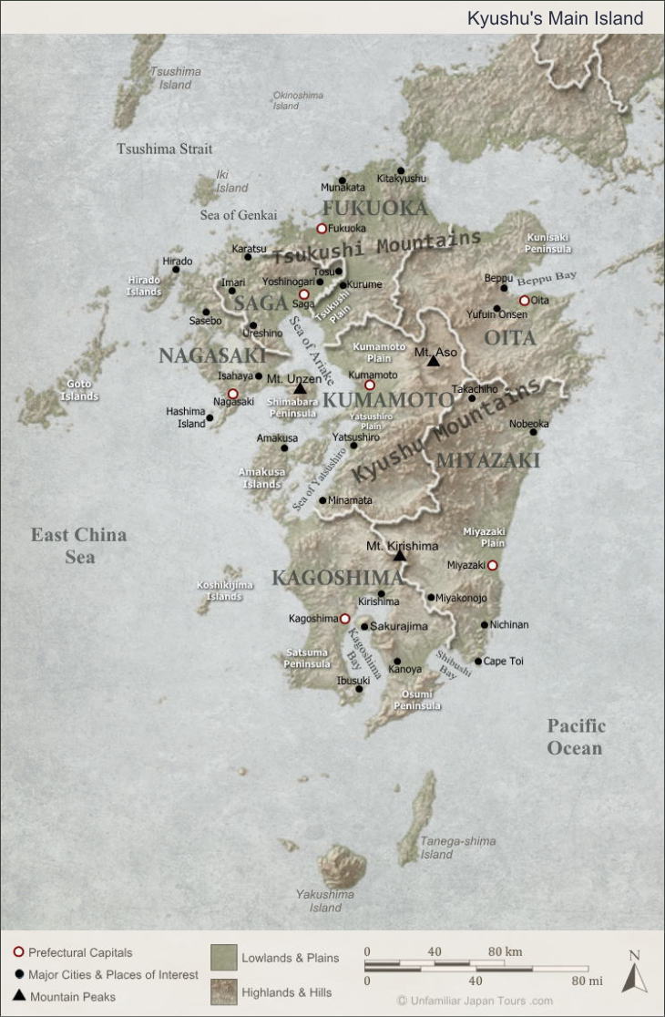
The winter climate is slightly different even within the main island of Kyushu. This climatic difference mainly comes from its two big mountain ranges: the Kyushu Mountains and the Tsukushi Mountains. Called the “Roofs of Kyushu,” the Kyushu Mountains are dominant at the center of the main island. And it runs from the northeast to the southwest. Some of its peaks exceed 1,500m in height, and the tallest one is Mt. Sobo at 1,756m. The Tsukushi Mountains run east-west across the northern part of Kyushu’s main island. But these mountains are not as high and steep as the Kyushu Mountains.
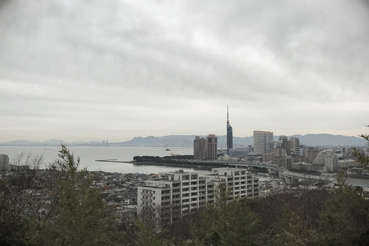
In winter, a humid seasonal wind blows from the northwest toward Kyushu. And, according to meteorologists, when it hits these central mountains, thick clouds form on the windward side. That is why the cities of Fukuoka and Kitakyushu in northern Kyushu (located on the northern side of these central mountains), for example, have a lot of cloudy days in winter. And these clouds can cause the occasional snowfall. However, once the wind crosses these mountains, it brings dry air to the leeward side. So, the city of Miyazaki in southeast Kyushu, for example, enjoys a lot of dry and sunny days in winter.
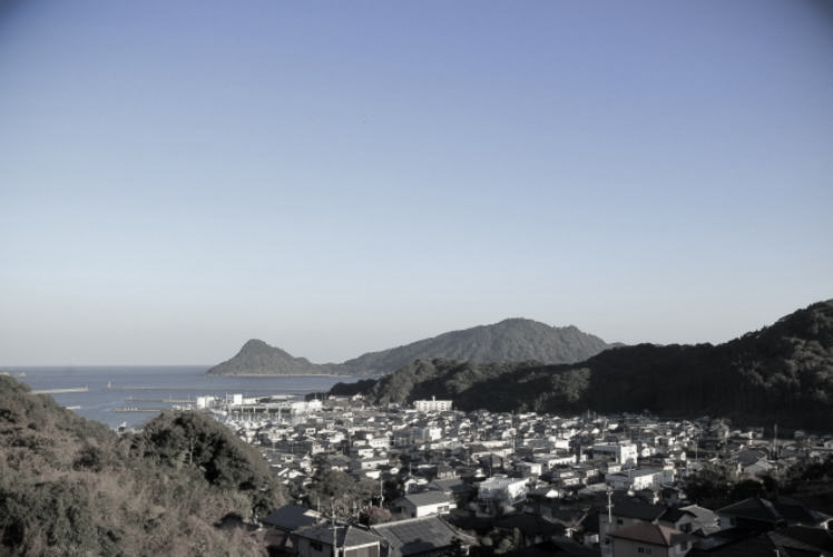
On the other hand, if you visit Okinawa in winter from the other areas of Japan, perhaps you will notice that it really is “warm.” Average winter temperatures in Naha City, the capital of Okinawa Prefecture, far exceed those in Tokyo.
History of Okinawa
Okinawa has a completely different history from the other seven prefectures located on the Kyushu main island. First of all, it was not part of Japan until the late 19th century. The area centered around the present-day Okinawa Islands was once governed by an independent nation called the Ryukyu Kingdom. Established in 1429, the kingdom developed through the intermediate trade connecting Japan, China, and other Asian countries. And a unique culture flourished there. But in 1609, it succumbed to the power of the Satsuma Domain of Japan, which included most of present-day Kagoshima Prefecture. And after the abolishment of the kingdom in 1872, it eventually became part of Japan as Okinawa Prefecture in 1879.
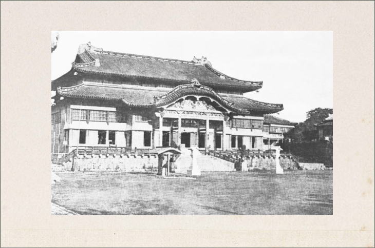
Today, if you visit the site of Shuri Castle or other historical ruins that dot the Okinawa main island, you might be able to imagine some of the past glories of the Ryukyu Kingdom. In fact, all of these historical sites related to the kingdom became UNESCO World Heritage sites in 2000 under the name “Gusuku Sites and Related Properties of the Kingdom of Ryukyu.”

World War Two
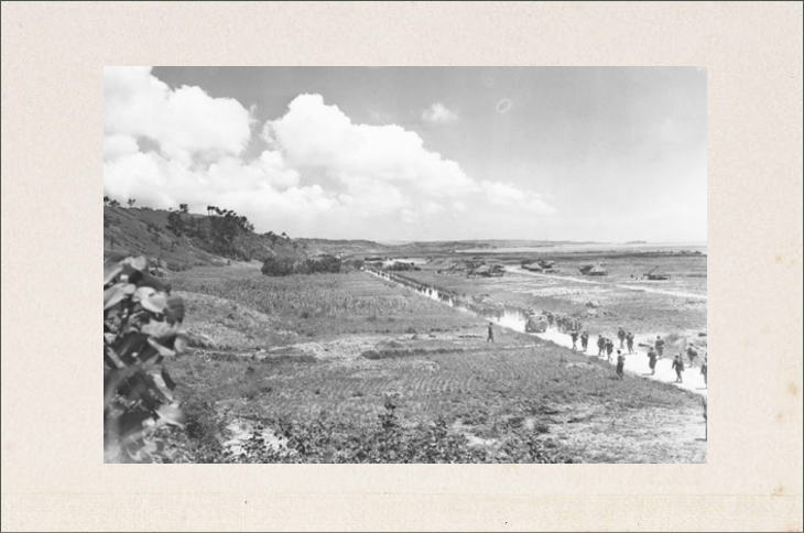
Okinawa’s hardships continued even into the 20th century. The Battle of Okinawa, which was fought between the United States and the Imperial Japanese Army from April to June in 1945, turned out to be one of the biggest and fiercest battles of World War Two. Not only the combatants from both sides but also a considerable number of local Okinawans were caught up in ground battles and lost their lives.
For a little more than two decades after the war, the Okinawa Islands were occupied by the United States until they were eventually returned to Japanese control on May 15, 1972. But even today, a large portion of the land in Okinawa is still used as U.S. military bases. The presence of these bases exerts a strong influence on the local industries as well as the lives of local residents.
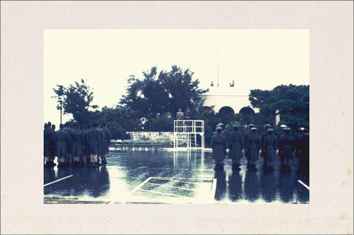
In this way, Okinawa went through many difficulties, and this complicated history makes Okinawa different among the prefectures of Kyushu. People in Okinawa have been well aware of this. And that is why the Kyushu Region is sometimes referred to as the Kyushu-Okinawa Region.
Photographs: Properties of Unfamiliar Japan Tours.com, unless otherwise noted.
Outbound Links (New Window)
