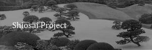
Overview
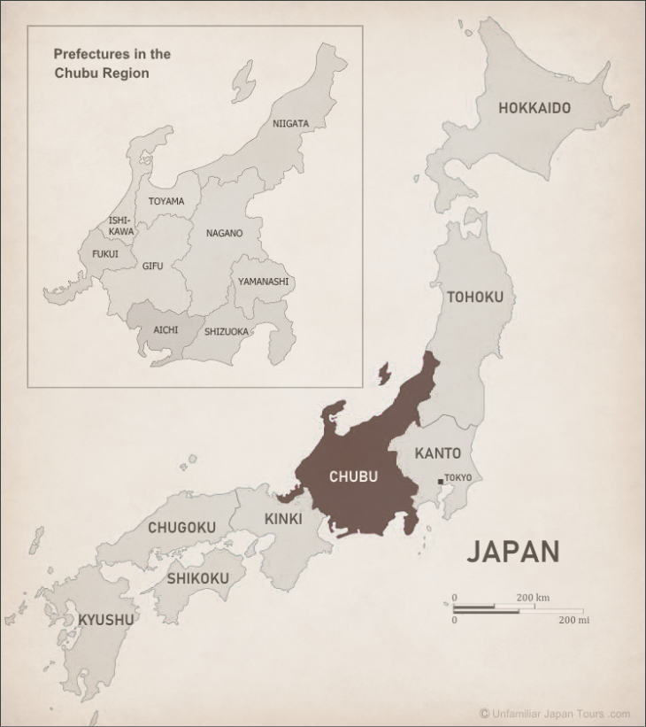
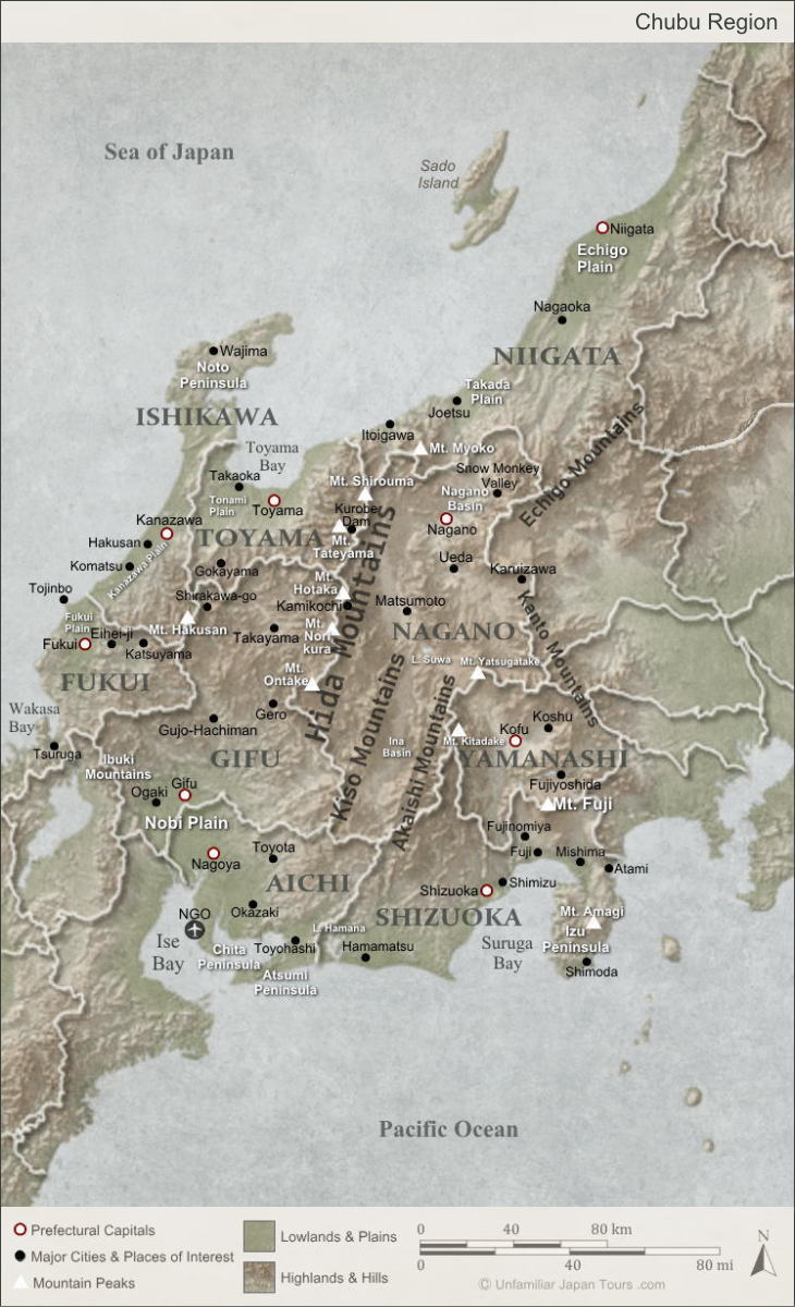
The Chubu Region occupies a large portion at the center of Honshu, the main island of Japan. And it includes nine prefectures: Aichi, Gifu, Shizuoka, Yamanashi, Nagano, Niigata, Toyama, Ishikawa, and Fukui. The land area of this Region is wide from north to south. In addition, there are big differences in elevation from flat lands by the seaside to steep mountains in the central area.
Because of these geographical features, the Chubu Region has a couple of different climatic zones. As a result, there are a variety of industries and cultures thriving here. And this makes it very difficult to describe the Region in one sentence. Or, maybe this diversity itself is the very identity of the Chubu Region.
The Chubu Region is usually divided into three areas (sub-regions): Tokai, Hokuriku, and the Central Highlands. This way of dividing the Chubu Region is commonly used by us Japanese.
Map of Chubu
Tokai Area
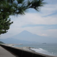
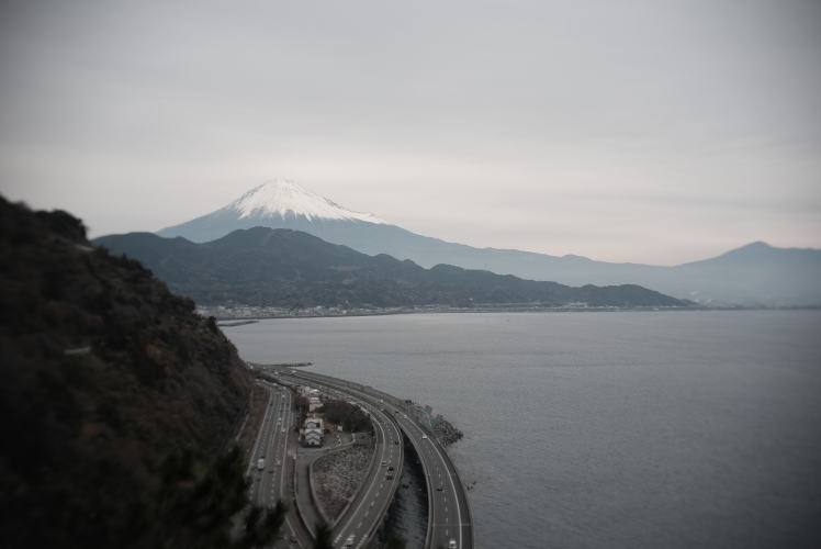
The Tokai area is the southern part that runs along the Pacific Ocean. With Nagoya City as its hub, this is the area where a large number of the population is concentrated. And various manufacturing industries and businesses flourish here. The climate of Tokai is relatively warm and mild (though the summer is humid with a lot of rain). And this area has a lot of interesting aspects in terms of agriculture and tourism.
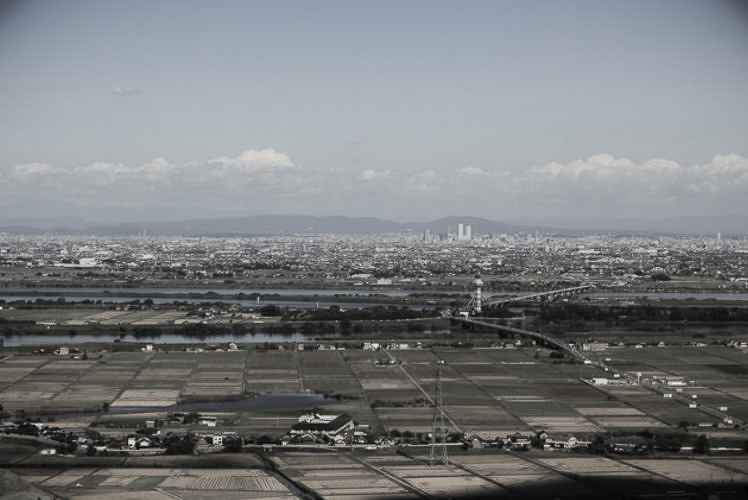
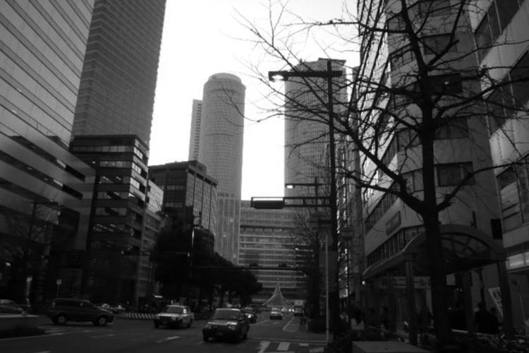
In the southern part of Gifu Prefecture flows three big rivers: the Kiso, Nagara, and Ibi. They eventually flow into Isa Bay, forming a vast flat land in their lower reaches called the Nobi Plain. This is where Nagoya, the biggest city in the Chubu Region, is located. The population of Nagoya and its surrounding area began to increase after the Second World War. And now the expansion has crossed the prefectural borders and formed a large metropolis called the Chukyo Metropolitan Area. It is the third largest metropolis in Japan after the Greater Tokyo Area and the Keihanshin Metropolitan Area.
Hokuriku Area
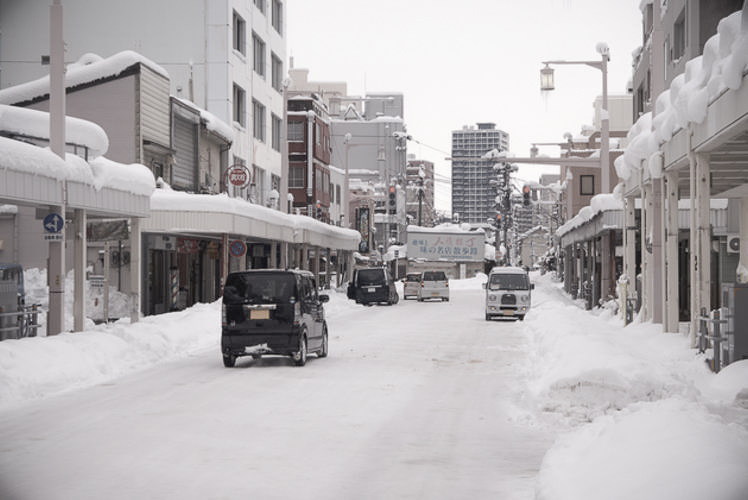
The Hokuriku area contains four prefectures along the Sea of Japan: Niigata, Toyama, Ishikawa, and Fukui. This area gets a lot of snowfall in winter. For example, Takada in Joetsu City (Niigata Prefecture) has the snow accumulation record of 3.77m (the record in 1945.)
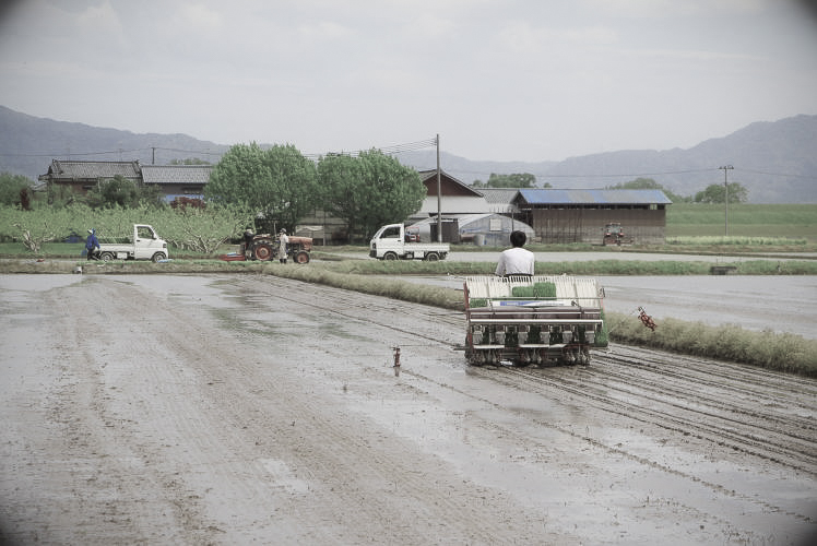
The snowfall melts in spring, providing the rice paddies with much water. For this reason, obtaining water has never been a big issue for rice farmers in this area. And that is one of the reasons why Hokuriku has become one of the top rice-growing areas in Japan, both in quantity and quality.
The Central Highlands
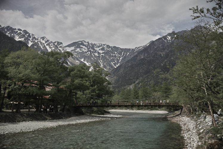
The Central Highlands are sandwiched by Tokai to the south and Hokuriku to the north. This is a mountainous area where Japan’s three biggest mountain ranges run side by side from north to south. People call them the ‘Roofs of Japan’ or the ‘Japan Alps’. It is mainly because many of the peaks are really high, exceeding 2,500m, and several of them exceed 3,000m.
A couple of narrow plains, which are not so large in area, exist between mountains. People call these types of plains bonchi or basins. And these are the places where the population of the Central Highlands is concentrated. These basins have a typical ‘inland climate’. That is to say, humidity is low, there is not much precipitation throughout the year, and the temperature differences between days and nights are large. Under these climatic conditions, unique industries and farm production have developed here.
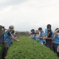
Farming in the Central Highlands
Fruit cultivation has been thriving in many parts of Nagano Prefecture since many years ago, taking advantage of landforms called alluvial fans. These days, Nagano Prefecture is the second largest apple producer in Japan, behind only Aomori Prefecture. The prefecture also has Kawakami Village on its eastern border with Saitama Prefecture. This village is unique in that the entire village is located at a height of over 1,000 meters. According to its official publication, the average temperature of the village in August which is 19.5 degrees Celsius is usually lower than that of Hokkaido (20.5 degrees Celsius). About 60% of the working population in the village are farmers. And the quantity of lettuce they produce in the vast fields is one of the largest in the country.
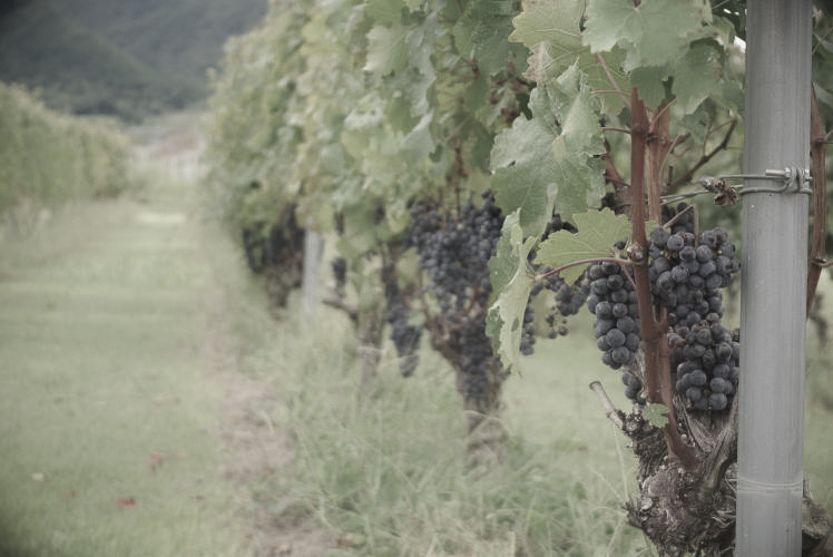
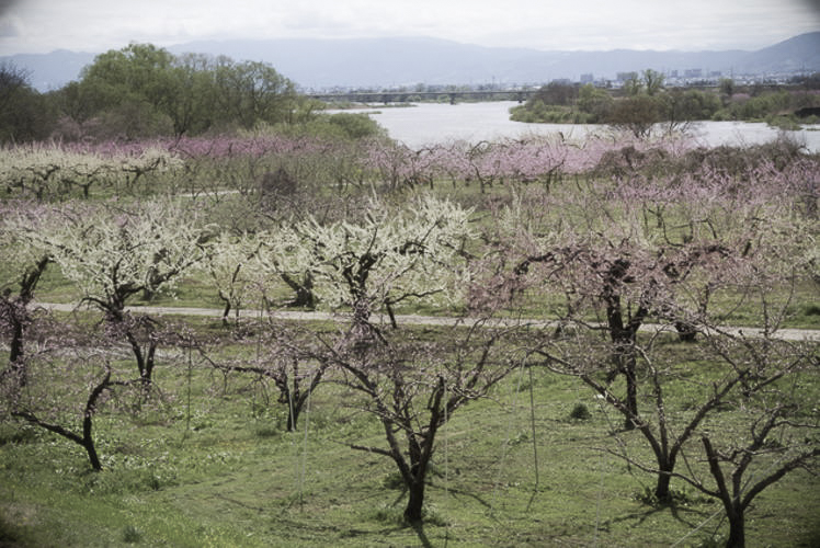
Yamanashi Prefecture is also famous as the ‘fruit kingdom’. The prefecture is the premier producer of a couple of fruits, such as grapes, peaches, and plums. In particular, Katsunuma Town in Koshu City is the place where grape cultivation was first started in Japan during the Kamakura Period (1192 – 1333). The town is also known as the birthplace of the Japanese wine industry. Today, the town has over 30 wineries, and their total wine production accounts for about a quarter of the country’s total. The white wine from Katsunuma goes very well with Japanese dishes, and in recent years, it has been attracting growing attention from wine drinkers overseas.
Photographs: Properties of Unfamiliar Japan Tours.com,
unless otherwise noted.
Internal Links

Outbound Links (New Window)


")


")